Day 5: OSM - Extracting 3D Buildings Data from OpenStreetMap
Extracting 3D Buildings Data from OpenStreetMap
For today’s map, I was challenged to use data from OpenStreetMap (OSM). If you are unfamiliar with OSM, it is kind of like a Wikipedia for mapping with GIS data that anyone can access and export for free. It contains a trove of crowdsourced geographic data for all over the world. The fact that it is free makes it an attractive resource for an array of applications and services.
For today’s mapping project, I will demonstrate a method for Windows operating systems that I recently found for downloading 3D buildings data from OSM. In this post, I will cover how to extract 3D buildings data from OSM and bring it into Microsoft’s 3D Builder, using another opensource tool called OSM2World. This free tool will convert .osm files to .obj file types, which are readable by Microsoft’s 3D Builder, a 3D modeling program that comes standard on Widows 10 PCs. While I am using the post to show how to pull in 3D renderings of city skylines to a design program, this workflow can also be applied for pulling down building data for manufacturing 3D prints, as 3D Builder can export 3D data as .stl files, which are commonly used for 3D printing.
Process
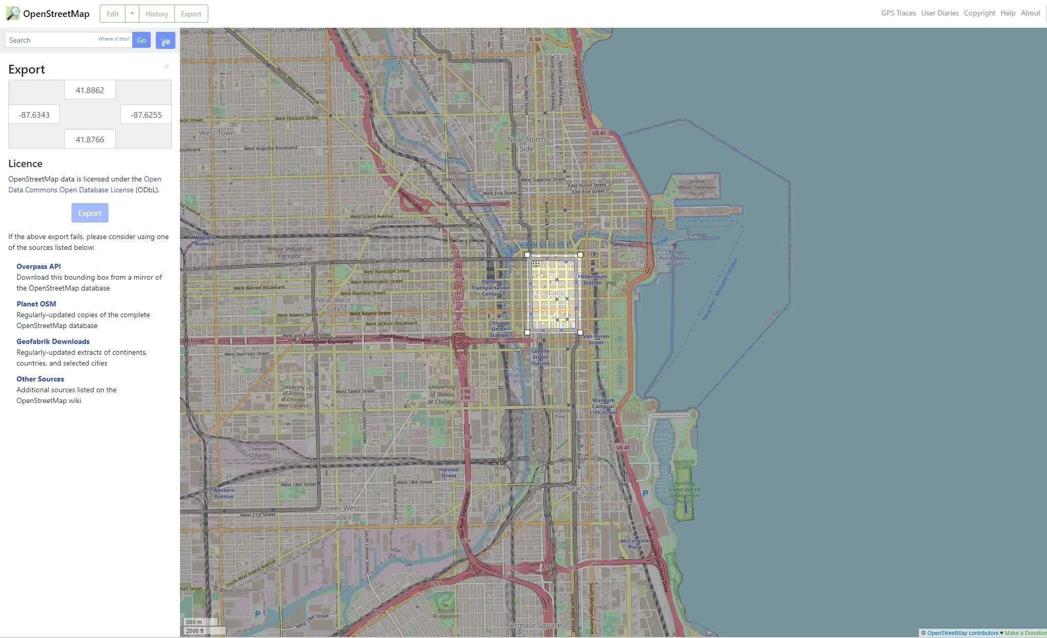
To get started, you will need to visit OpenStreetmap.org to get the data. I decided to pull in data for the Chicago Loop, a commercial district in downtown Chicago with a prominent skyline populated with high-rise towers. To get started, I visited the OpenStreetMap homepage and navigated to the Loop neighborhood of Chicago. Next, I selected the “Export” button in the top left corner of the screen. I then choose the option “manually select a different area” option under the Export menu (note . You can then manually draw the area of interest you want to download data from. Note that there are size limitations that restrict how big of an area you can download at one time.
I centered my area of interest over the Chicago Loop and clicked the blue “Export” button located in the left-hand panel, mid-way down.
Once I had my OSM data, I launched OSM2World and imported my data into it. Below is the result:
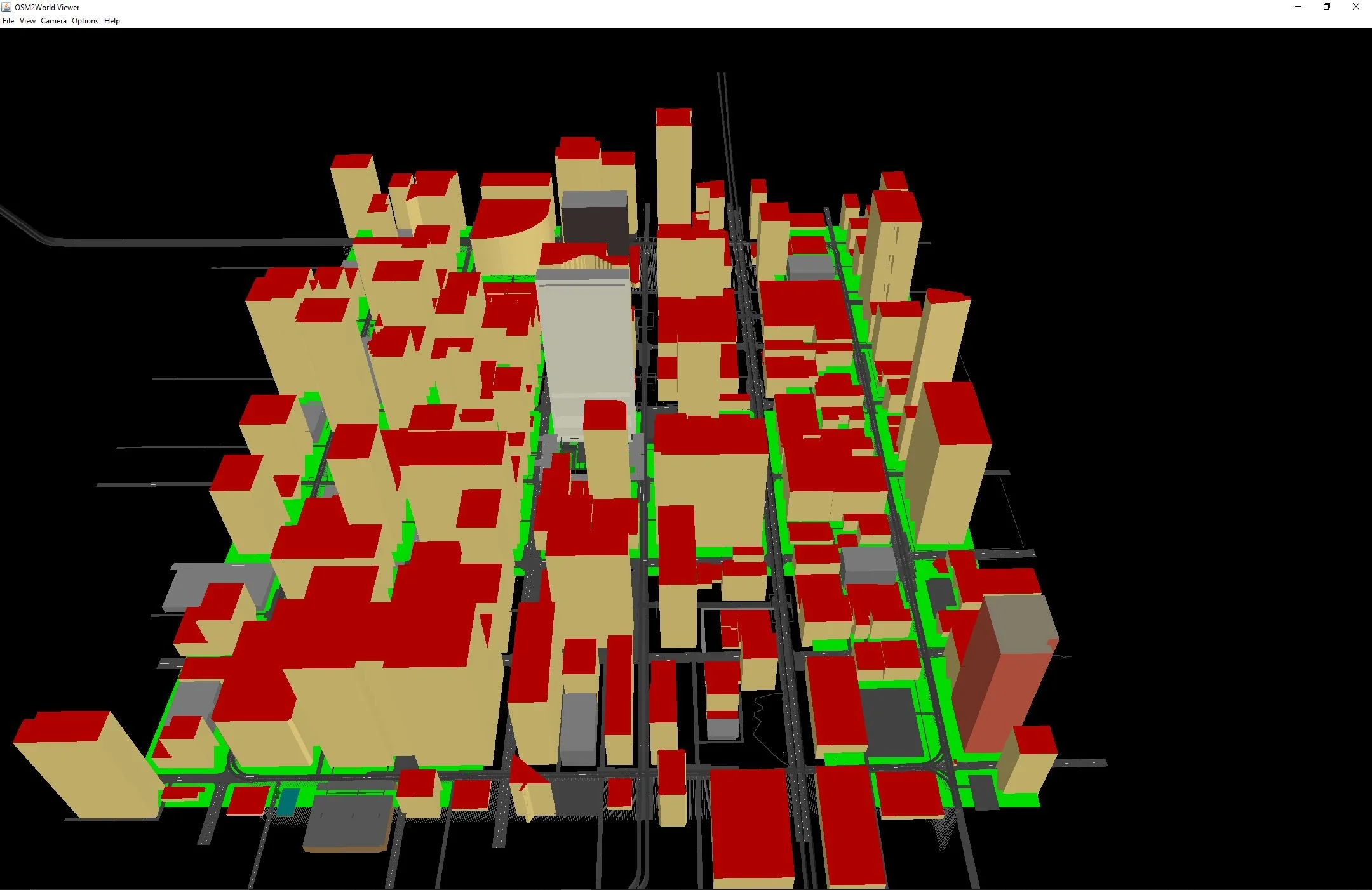
Now it’s getting interesting. This tool shows renderings of buildings from the Chicago Loop. we can see other elements too, likes roads, rail, and what appear to be footpaths. it kind of resembles a scene from a 1990s videogame. Next, we will use the OSM2World tool to convert this file to an .obj file type, which is supported by 3D Builder.
To do this, select file > export obj file to convert this to an .obj file type. Once complete, this file is now ready to be imported into 3D Builder.
Below is the result:
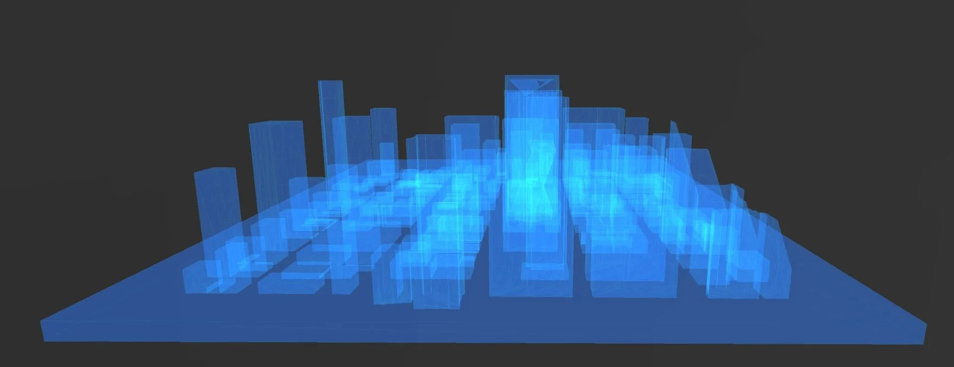
Within 3D Builder, you can tinker around further and save the file as .stl file type for 3D printing. Happy mapping!