Day 24: Historical Map – FDR’s Electoral Victories
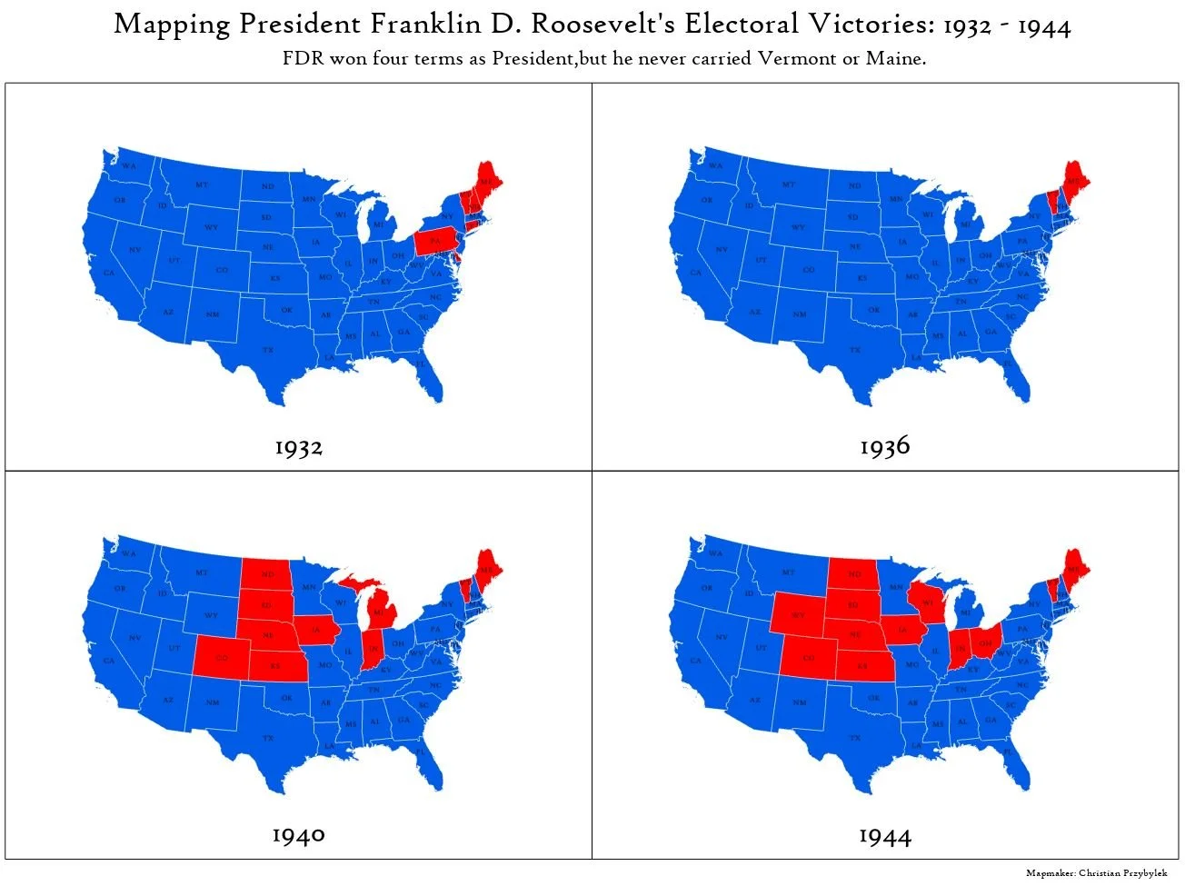
Mapping President Franklin D. Roosevelt's Electoral Victories: 1932 - 1944
Today’s mapping challenge theme is around something historical. As an armchair political science and history nerd I thought it would be neat to map the outcomes of the United States presidential elections of 1932, 1936, 1940 and 1944. I was interested in these specific presidential election years because in each race, Franklin Delano Roosevelt (FDR) won. FDR is a unique historical figure, in part because he was the only American President to break with George Washington’s precedent of serving no more than two terms in office and was elected to four terms, fully serving 3 terms, and dying in office during his fourth in 1945. His accomplishment of serving more than two terms is now constitutionally prohibited by the 22nd Amendment, which was passed by Congress in 1947 and later ratified by the States in 1951.
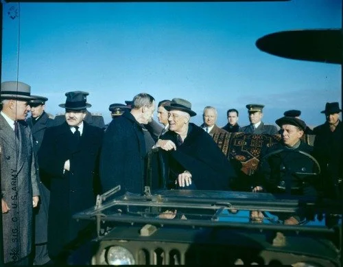
picture of FDR at the Yalta Conference. Photo source: Franklin D. Roosevelt Presidential Library and Museum
Volumes have been written on the political career and accomplishments of FDR, and his impact on American society extends far beyond the scope of this post. As a geographer who is interested in the American political system and 20th century American history, I find FDR’s electoral strategy and the politics of the 1930s and 1940s fascinating. He came into office during the height of the Great Depression advancing progressive New Deal legislation and championing the American working class and organized labor. He then led the US and the Allies through most of World War II, until his death in office in 1945 (as an aside, here is an excerpt from Elanor Roosevelt’s radio address to the nation after the attack on Pearl Harbor that I had only just recently heard for the first time). FDR’s consecutive set of electoral victories were monumental, especially when compared to the tight election results we experience in today’s hyper partisan, polarized environment.
Approach
For today’s map, I wanted to explore the FDR election results data by state to see if I could detect any interesting or intriguing patterns. My approach was to map electoral results from FDR’s four presidential runs using a change map, a useful cartography technique for visualizing change overtime where you create a set of maps show data over the same area, but from different points in time. For this project, I mapped each of the four-election year electoral results by state, showing the winner of each state. Note that during these elections, Alaska and Hawaii were not yet states and Washington DC would not be granted its 3 electoral college votes until 1961.
The four resulting maps (see above) displaying US presidential election results by year make quick comparisons easy. What I noticed is that while FDR won four terms as President, he never carried Vermont or Maine. Today, Vermont is solidly “blue”, while Maine leans democrat. There are other interesting things to note. For example, Aft Landon appears to have been a particularly poor choice as the Republican frontrunner in the 1936 election, losing all but two states. Also, starting in 1940, something curious started happening in the Midwest, as these states reliably flip parties. I am curious about why those states started to flip. It could have been pushback to the war effort, or concerns over the way the New Deal was transforming American society. In any case, this was a fun exercise in mapping.

