

Day 18: Water – Using the Spilhaus World Ocean Map in a Square Projection to map the World’s Major Ocean Currents
Using the Spilhaus World Ocean Map in a Square Projection to map the World’s Major Ocean Currents
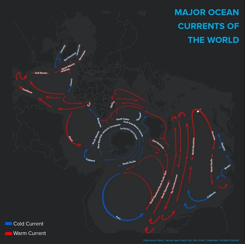
Today’s mapping challenge theme was water and I decided to go big. I mapped the world’s major ocean currents using one of my favorite map projections, the Spilhaus World Ocean Map in a Square. This eye-catching projection, designed by the Oceanographer Athelstan Spilhaus in 1942, centers a world map’s focus onto the planet’s oceans, displaying them as part of a larger contiguous body of water.
Approach
First, changed my map’s projection coordinate system to the Spilhaus World Ocean Map in a Square projection, which is supported in ArcGIS Pro. Next, I pulled in a major ocean currents layer from the National Oceanic and Atmospheric Association (NOAA), using Esri’s Living Atlas portal. This layer, once in my map, rendered major world ocean currents as thick red and blue lines, with red lines indicating warm water currents and blue lines indicating cold water currents. Once I had my data set, I experimented with the symbology and background. I decided to bring in a dark themed basemap. I found the darker basemap theme was effective at highlighting the ocean current lines and allows for less important details to recede into the background of the map. I had to do some fine tuning to the basemap layer to hide to polar gaps, which appear as white circular gaps otherwise. Finally, I labeled each major ocean current and centered the text over the current lines. The result is a map that shows the world’s oceans as part of an integrated, global system comprised of circulating warm and cool currents of water.
I like how this map projection centers a viewer’s attention onto the world’s oceans and pulls it away from the world’s large land masses. It provides a unique perspective and lets you see the world in a new way.
Further reading:
Esri has a great story map style article detailing the history and recent resurgence of this projection.
Learn more about the world’s major ocean currents and ocean circulation, here.