30 Day Map Challenge 2020 - Day 26: Map With A New Tool
Day 26: Map with a new tool
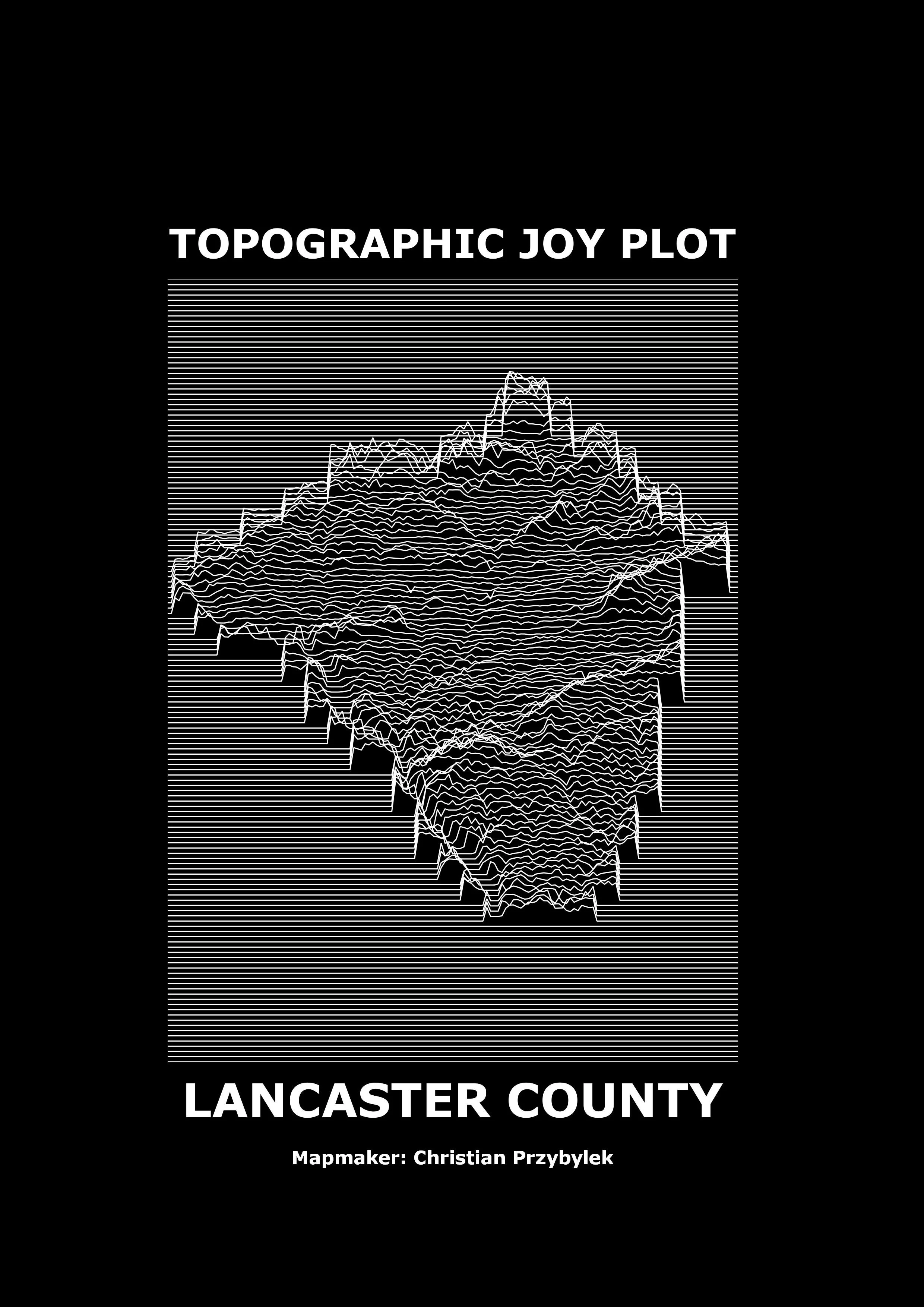
Subject: For today’s map, I decided to make a Joy Plot showing the topography of Lancaster County, Pennsylvania. I used a Digital Elevation Model raster file and a method in QGIS for creating this map. Also called Ridgelines, this cartographic technique uses lines to highlight changes in elevation across a landscape and has a neat feel to it. The term Joy Plot was coined by the geographer James Cheshire (check him out on twitter), who named the technique after the punk band Joy Division, whose 1979 album cover, “Unknown Pleasures” features an elevation Joy Plot.
Tools: QGIS

Joy Division's 1979 Unknown Pleasures album cover